A primer on urban mobility
Metro Manila’s geography and land use decisions have contributed significantly to traffic congestion
(First of a series)
Real estate’s tired but enduring three principles of “location, location, location” will always be universally relevant. But what exactly determines good location?
Intuitively, these are places enjoying a good amount of traffic and visibility: at crossroads, at points of changes in modes of transport, and at places of good accessibility and connectivity. These attributes contribute to concentration and agglomeration of activities, which are the essence of cities.
Networked systems
Cities are networked systems. They behave in the same way that the virtual world of social networks and computer systems behave: they are hubs that connect to other nodes through links. The greater the number of links a particular node or hub has, the more it attracts new links (Law of Preferential Attachment in Networks).
In the physical world, mobility systems such as roads, transit, air and sea ports are the links that connect people and bring them together to the hub called cities to enable the exchange of goods, services and ideas.
Within the cities are smaller networks of hubs, nodes and links organized in a certain self-sameness of form and functionality. The best locations are hubs with the most links enabled by mobility. And just like social networks, the best sites attract more links and connections.
Unfortunately, in the physical world, the number of connections is limited by the capacity of the links (transportation) and thus, the downside of good locations, as we presently experience it, is congestion and longer commute times.
Challenges of geography
Part of what drives the capacity for urban mobility is the lay of the land. Metro Manila, for instance, has Laguna Lake and the Montalban mountains to the east and Manila Bay to the west. This location, while ideal during the time of water transport and before the city had to grow exponentially in size, created constraints in the expansion of the metropolis and concentrated urbanization and mobility in a confined space determined by topography.
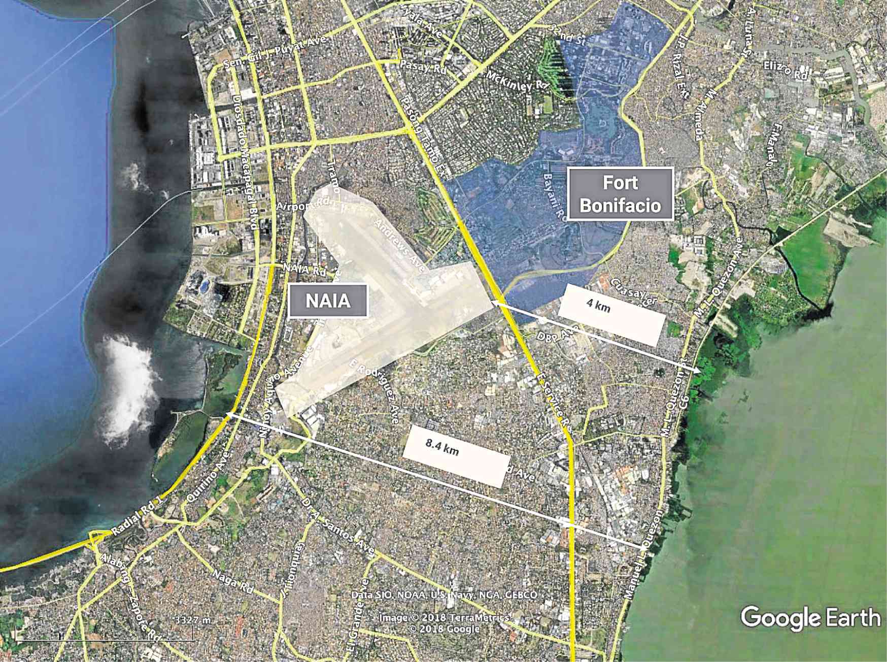
South of Metro Manila, the land mass is just around 8 kilometers wide. If you consider the areas with restricted access along that narrow waist such as the gated subdivisions, airport and former military bases that further constrained the transport corridor, then it comes as no surprise that congestion happens along South Luzon Expressway during peak hours.
 In Metro Cebu where the city is confined to a narrow stretch between the sea and mountains, urban development and land transport follow a linear path, hence the congestion now experienced in the city.
While the challenges of geography are not insurmountable and can be addressed by creative land use planning, better infrastructure or new forms of mass transport, these solutions will still, ultimately and inevitably, have to contend with the physical limitations of the site.
Form follows infra
The size of cities is determined largely by its transport shed or its commuting distance.
Cities were more compact when the primary mode of travel was by foot. As technology allowed for faster mechanized transport, the limits of the city have increased, absorbing the hinterlands into ever larger conurbations. Paradoxically, while transport’s goal is to ease mobility and reduce congestion, they also consume space.
And in highly urbanized areas where transport is most needed due to a need to serve a high number of people, space is very rare and very valuable.
Braess’ Paradox
Most metropolitan areas react to congestion by adding more highways, more road lanes or extending road networks into farther areas.
This, however, has mixed results: adding more roads to an already congested network can result in more congestion and longer travel times, a phenomenon known as Braess’ Paradox. The paradox is also more humorously captured by Lewis Mumford when he said, “Adding car lanes to deal with traffic congestion is like loosening your belt to cure obesity.”
The key factors behind this dilemma has to do with society’s behavioral tendencies, in particular our dependence on specific paths and modes of transport (i.e. cars), further aggravated by the fact that road usage is essentially free.
Mega Manila’s population may double within the next 24 years, growing on average by 1 million per year
The combination of these three elements creates the recipe for negative externalities: the use of a congested road by any individual will adversely affect others. Improving economic conditions and an increasingly affluent population will tend to increase car ownership and therefore reinforce automobile dependence leading to congestion which prompts adding more road capacity in a vicious loop. Providing mass transit along the same established vehicular routes, while it is a step in the right direction, is often not a complete solution since it reinforces path dependence.
Perhaps the way to begin addressing the urban mobility dilemma is to deal with the key factors that create it: reducing mode dependence and path dependence. (To be continued)
The author is founder and principal of Joel Luna Planning and Design, a masterplanning and property development consultancy practice with extensive experience in mixed use developments and townships. www.jlpdstudio.com