


Scientist mulls use of flood maps to lessen El Niño’s effects
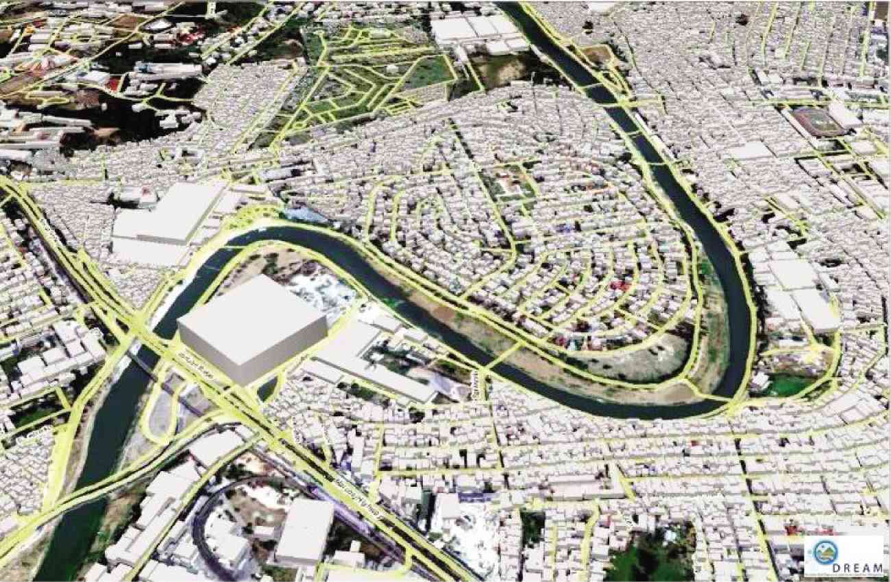
SCREENSHOT of a map using the Lidar (Light Detection and Ranging) technology of DREAM (Disaster Risk Exposure and Assessment for Mitigation), one of the programs under Project Noah Photo by Project Noah
What if the maps used to warn people in flood-prone areas are harnessed to find places where they can store water for the dry season?
That is what the head of UP Disaster Risk and Exposure Assessment for Mitigation (UP DREAM), Dr. Enrico Paringit, is thinking to literally stem the loss of water supply for irrigation this coming El Niño taking his cue from Science Secretary Mario Montejo’s musing two years ago to “sacrifice” a portion of the Pampanga River Basin to store water, while observing their work there.
It is in response to the alarm raised recently by the Philippine Atmospheric, Geophysical and Astronomical Services Administration, which said the country will face a severe El Niño starting October, that will surpass the same episode 17 years ago when 70 percent of the country experienced severe drought and suffered water and food shortages.
Paringit said UP DREAM’s light detection and ranging (Lidar) technology, which produced up-to-date three-dimensional maps of the country’s major river systems where communities are prone to destructive floods, can also be used to locate possible sites that can serve as catchment ponds or impoundment.
El Niño’s wrath
El Niño is a recurring unusual warming of sea surface temperatures in the central and eastern equatorial Pacific. In the country, it is characterized by reduced rainfall and can cause the erratic behavior of tropical storms. The state weather bureau expects El Niño to peak in November this year to January next year and to last until May next year.
Small temporary reservoirs for agricultural purposes are already popular in the countryside, but most of them are decided only through trial and error, said Paringit. “There is small danger when you intentionally flood an area, and with the method you’ll use to stem the flow of water. Through the Lidar and the flood maps, we can have a more systemic approach.”
Part of the Department of Science and Technology’s Project Noah (Nationwide Operational Assessment of Hazards), UP Dream’s Lidar created 3D images of the country’s 18 major river basins, which affect 58 cities and 598 municipalities in 49 provinces, plus watersheds. The maps can simulate flash floods, pointing to areas that will be submerged in water and to others that will be safe during heavy rains.
According to Paringit, through Lidar and the flood maps, authorities can also determine the following:
1Possible source. Whether it is a direct run-off from a tributary (a stream that flows into a larger stream or river) or where water can be diverted from and directed to the impoundment
2Capacity of the area. How much water it can take in.
“As soon as we identify [these impoundment], we can give recommendations to the concerned agencies, like the National Irrigation Administration and the Department of Public Works and Highways, for them to implement [the necessary damming projects],” he added.
“It can be a strategic way of addressing the issue. We can do temporary [damming] every time there is a drought or an El Niño event, and later remove the dams when things are normal. The important thing here is that we can trap the water whenever we need them, instead of letting all the water flow away,” he added.


