
Fast lane living
Households would like to be comfortably close to highways and main roads because of the premium given to access and mobility. (HTTPS://PHILTOYOTA.COM)
The general preference for real estate locations that are near major lines of mobility underlies the urbanization process and city formation.
Mobility is enabled by a network of linkages that is laid out in hierarchical order. At the top of this order are the national primary roads that provide access across towns and cities.
The Department of Public Works and Highways (DPWH) defines this as “a contiguous length of significant road sections extending linearly without any breaks or forks that connect major cities (at least around 100,000 population) comprising the main trunk line or the backbone of the national road system.”
Presidential Decree No. 17 defines the term highway to include “pavements, shoulders, embankments, rights-of-way, bridges, ferries, drainage structures, signs, guard rails, and related protective structures,” whereas Presidential Decree No. 957 and Batas Pambansa Blg. 220 provide for road hierarchies with stipulated measurements for the main roads of residential subdivisions and socialized housing projects.
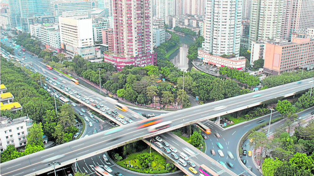
Proximity to wider roads typically means more air space and possibly better visual amenities. (FILE PHOTO)
Social and economic underpinnings
Highways are regarded as gateways that pave the way to new opportunities for places to flourish.
The agglomerative effects of these infrastructure projects are reflected in the concentration of built-up areas that are served by the highway systems in the Philippines. The transformative effects are evidenced by the changes in demographic profiles that translate to the expansion of the secondary and tertiary economies.
The sociocultural connotations are captured by the idea of the fast lane life, which is associated with being exciting, busy, and successful. Other language expressions of privileged access such as “inner circle” and “in the know” underpin the value of being within a close social or physical distance.
The economic value of being along or close to main road locations is gleaned from the price structures and resale values of real estate.
Marketing strategies would typically describe properties for sale in terms of their distance to the highway and other city amenities. “Along highway” plots in subdivision developments are often designated as commercial areas. Lots along the main roads are priced higher as the latter are usually connected to the development’s communal and open space systems.
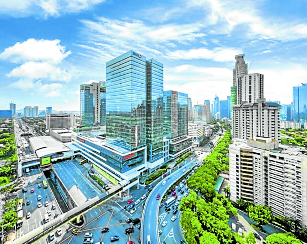
Highways serve as connectors that drive development.
Positive externalities
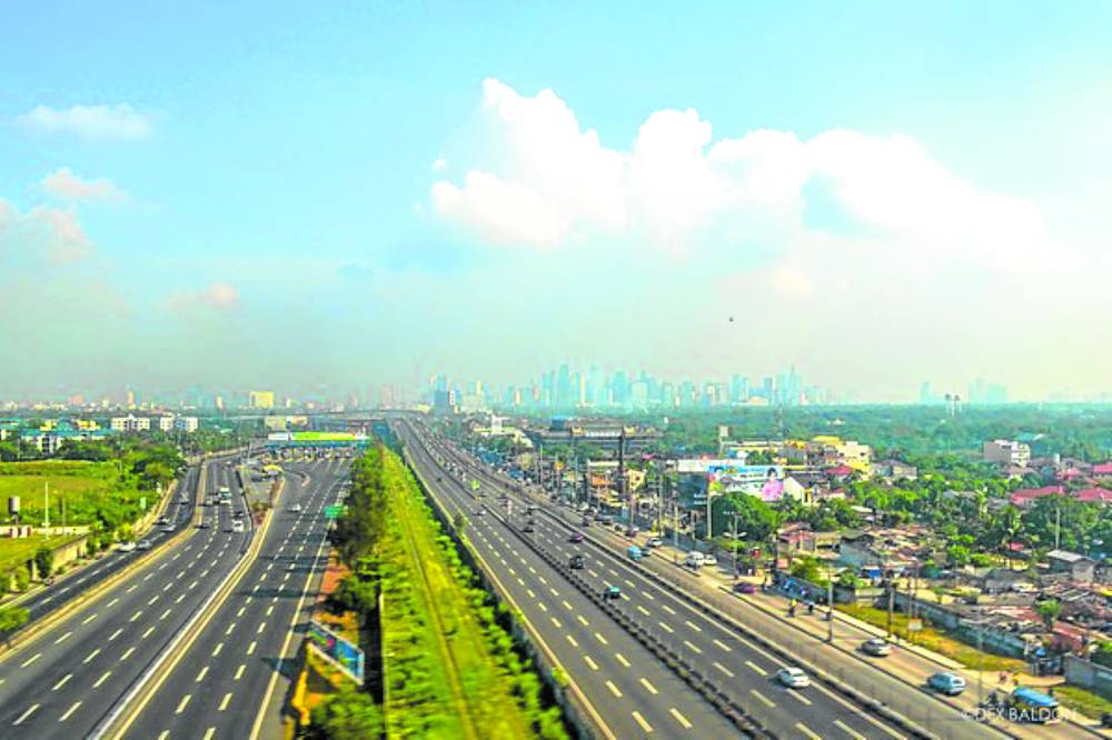
Households would like to be comfortably close to highways and main roads because of the premium given to access and mobility.
As people navigate the city for routine activities, the ease of travel allowed by the connection to public transportation—from tricycle terminals to mass rail transit stations—can easily account for a better quality of life.
The advantages of being close to highways are also experienced during special and seasonal trips to airports and seaports. Availing of the benefits of delivery applications in this age of online shopping is maximized by urban infrastructure that expands the reach of goods and services.
Mobility and access to open spaces are also important during emergency situations due to nature-induced disasters.
Relocating to higher ground in cases of flooding and moving to open areas during earthquakes are aided by wide and unobstructed paths. Proximity to wider roads typically means more air space and possibly better visual amenities.
All these place attributes add value to real estate and can positively contribute to price factors.
Negative externalities
While proximity to highways is generally desired, being right along or too close to these fast roads may not be preferred by some due to negative externalities that can also result in lower real estate value.
Noise and air pollution due to passing vehicles are downsides to living near busy thoroughfares. The rate of gentrification resulting in neighborhood changes may also negatively impact life quality. Land use reclassification from residential to commercial can result in privacy issues as activities in the area become more intense.
Social activities that are accommodated in slow and calm streets may not be possible in fast road settings. In some neighborhoods, the streets become linear social spaces and serve as extensions of the private lots during community parties, fiestas, and even during pre-funeral wakes.
Road congestion and accidents due to fast-moving vehicles are some of the other factors against highway proximity.
Planning and regulatory measures
Laws are in place to ensure that risks to life and property safety and well-being are mitigated as the places get more interconnected via highways.
The implementing rules of Presidential Decree No. 1096 or the National Building Code of the Philippines provide for setback requirements and sidewalk provisions. There are also prescribed distances for road intersections to the parking entrances of buildings, as well as restrictions in the installation of billboards, ambulant vending, and slow-moving vehicles. Local ordinances also prescribe delivery times for trucks and vans.
In city planning, there are allowed uses and restrictions specified in the zoning ordinances which are formulated based on the comprehensive land use plan. These road areas that fall under inalienable land are laid out based on the long-term vision for the city or municipality. A transport corridor overlay zone may be designated to provide more detailed guidance on how highway-oriented development may be directed or redirected. Form-based zoning (Parolek, D.G., Parolek, K., Crawford, P.C.,2008), which institutionally enforces the visualization of future urban form, may be formulated based on the urban transect concept.
A transect is a sequence of spaces where the transition from urban to rural may be visualized through a road hierarchy (Duany, A., Speck, J., Lydon, M., 2010).
The urban fabric, which is physically defined by the system of roads, built-up blocks, and open spaces (Lynch, 2024), also serves as a determinant of urban intensity.
People and environment effects
Highways serve as connectors that drive development by enhancing the processes of convergence and integration.
With their catalytic attributes, careful thought must precede the decisions on where and how these lines will be laid out. Planning should consider not only the economic dimension, but should be multi-sectoral to factor in the effects on people and the natural environment.
Highways connect but can also be divisive as they cut through existing communities, rice fields, and heritage areas. They can have marginalizing effects when gentrification sets in and when areas become car-centric.
These lines of movement lead to significant and irreversible changes in the impact areas. These concerns need to be balanced with economic development goals when making investment decisions on these infrastructure projects.
References: Duany, A., Speck, J., Lydon, M. (2010). The Smart Growth Manual. McGraw Hill; Lynch, K. (2024). The Image of the City. MIT Press, 2024; Parolek, D.G., Parolek, K., Crawford, P.C. (2008). Form-based Codes. John Wiley & Sons, Inc.
The author is a professor at the University of the Philippines College of Architecture, an architect and urban planner