The networked central social districts
| PHOTO: MAke It Makati
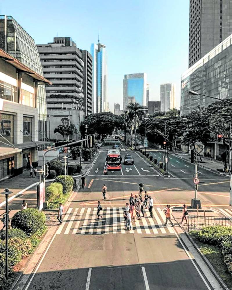
A fascinating evolution has been taking place in the metro over the past few decades: the rise of social districts.
We see these compact, high-density, mixed-use districts, which have a strong focus on retail, dining, and entertainment, at the fringes of the more traditional central business districts (CBDs) of Makati, Bonifacio Global City, and Ortigas, as well as Rockwell, Eastwood, Uptown Bonifacio, Capitol Commons, and many others.
These activity hubs are often no more than 20 ha in size. They serve as counterpoints to the larger business districts they are functionally and geographically appended to, offering social and recreational venues that give life to urban centers on weekends and afterhours.
Rise of social districts
How these social districts have grown in number over recent years is equally fascinating. They offer live-work-play destinations within the larger business realm of our CBDs—subdistricts of larger districts. They compete in the production of new urban spaces yet somehow have a symbiotic relationship with CBDs and with each other.
They have evolved organically within the metro, responding to market signals, with each node vying for primacy of location. They also share a common feature: an outdoor orientation which not only allowed these venues to thrive during the pandemic but also served as de facto civic spaces.
The result is a polycentric configuration in which independent districts self-organize into a hierarchical system of nodes that form a networked metropolis. These districts form a patchwork of compact, commercial nodes linked to the larger CBD by mobility corridors (roads, transit or proximity). Symbolically, they also draw from the identity and energy of the larger CBD. Each one thrives because of this nested structure. What is Rockwell without Makati CBD, or Capitol Commons without Ortigas Center, for instance?
Microcosm of the metro
Each district or node is a mirror and a microcosm of the metropolis. They are functionally self-similar—mixed-use buildings within mixed-use districts within mixed-use cities, highlighting the fractal nature of urban areas. It is fascinating to observe that underneath the complexity and chaos of our metropolis is a subtle underlying structure—nodes nested within larger nodes in an entangled web of links.
BGC itself has evolved into a central social district, evidenced by the high foot traffic it enjoys even on weekends. But even BGC has several subdistricts, each a social node that builds on the larger township and thus creating a multiplicity of destinations.
This characteristic may offer insights for property development. How does one, for instance, decide which among these districts offer the best location? If we view the city as a network, we can then apply the principles of network dynamics in assessing the relative value of each location.
A hierarchal structure
It has been long known that urban spatial systems tend to follow rank-size principles.
Urban mobility, for instance, follows a hierarchal structure where commuters transfer between regional, high-capacity, long-range modes (commuter trains, buses) and local modes (tricycles or walking)—a Brownian tree that aggregates or diffuses with the flow of people. A district or node that is connected to a link that is higher in the hierarchy (connected to regional transport routes and multiple modes) will be more valuable than one that is only connected to minor links (accessible only by local transport or through a single mode, i.e., cars).
As a networked system, any change in a link can also trigger cascading effects to the rest of the network. The introduction of a transport hub or the pedestrianization of an important street can alter the dynamics between nodes, strengthening some while potentially weakening others.
Generating value
Ultimately, the value of nodes is determined by the number of links connected to it and the value of sub-nodes is determined by its connection to larger nodes. This is essentially Metcalfe’s Law applied in urban spatial structuring.
But despite this self-evident principle, there are developments that fail to recognize this. Many townships in the suburbs try to replicate the success of metropolitan urban centers by singularly focusing on creating destinations, neglecting the importance of the linkages that would make such destinations grow in significance.
Without these links, these townships become isolated nodes with limited capture and synergy. Speculative interest, government push or the strength of the developer’s brand may drive early investment in these townships, but the realization and growth of an actual mixed-use town will ultimately rely on the robustness of its links to larger urban areas.
Understanding how cities function like networks can inform many decisions in the property industry—from buyers and business locators looking for the right address, to developers seeking to improve the competitiveness of their projects, to government agencies who want to prime and promote certain areas, to investors seeking properties that can yield the best long-term returns.
Ultimately, it is about generating the most value out of a particular location. This can be achieved through strategies that harness the networked systems of cities.
The author is founder and principal of JLPD, a master planning and consultancy practice. Visit www.jlpdstudio.com