As an urban planner, I always go for the window seats when traveling by plane.
What one sees from the sky are urban geographies which reflect the intensely colluding activities that make up spatial concentration tendencies. Patches of densely built-up areas define towns and city centers where people, information and technology converge for the maximization of agglomeration benefits.
Following the bid-rent theory, the level of intensity is highest at the core where the central business district serves as the organizing hub of the urban ecological niche (Pacione, 2005).
When viewed at nighttime, the lights wane as the distance to the core increases. Around the edges of these patches of light are radiating lines making up a spider web-like form. These are the lines that connect the city centers to the more calmly disposed settlements right around the urban core. In some cases, these lines connect to other towns and cities, forming networks of built-up areas with hierarchically arranged corridors.
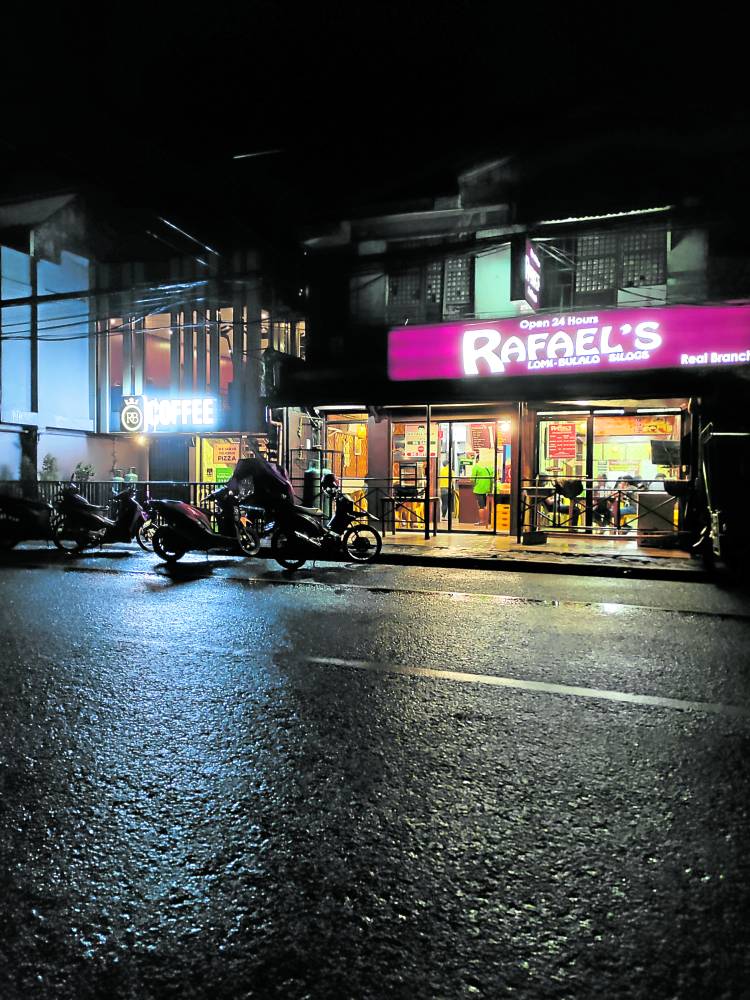
Ground level view of corridors
How are these lines like when viewed from the ground and what would account for these spatial features?
A road trip to neighboring towns in the Calabarzon Region would give us a sense of how the corridors figure in urbanization and the physical development of cities and countryside. In between built-up areas are either farmlands or industrial sites where land values drive location decisions for agriculture and manufacturing.
Another type of corridor experience would consist of stopovers for small-scale business transactions that are usually based on the town’s culinary and delicacy brands.
Roadside enterprises showcase items that give travelers a sense of where they are on their road trip.
The roadside food stops
En route to Nueva Ecija and passing through towns in Pangasinan, tupig stalls are lined up and are recognizable from afar because of the smoke coming from the roasting of banana leaf-wrapped glutinous rice delicacy. Small alfresco lomi eateries define the roads of San Jose and other towns in Batangas. The colorful dudol are hung in the less inhabited roadsides of Marawi.
And in recent years, quaint boutique restaurants have lined up along the bikers’ paths in Tanay, Rizal. These mostly transient spaces in Tanay are intended for rest and are now being complemented by small accommodation facilities with the view of the Sierra Madre mountains as main attraction.
Specialty products as branding elements
Aside from food, roadside enterprises also showcase products that give travelers a sense of where they are on their road trip.
Floaters and swimwear stalls emerge as one enters Pansol in Laguna. Brooms made of tiger grass or walis tambo and those made of palm mid-ribs or walis tingting are creatively displayed in the roadside areas of Cogeo, Antipolo.
While the products on display serve as wayfinding elements, these also project the town’s identity through the local industries. The three-dimensional corridor space is formed out of the ubiquity of place-based products that make up the industry agglomeration such as the hot spring resorts of Pansol and local materials such as the grass and palms of Antipolo.
Value of roadside enterprises
Entrepreneurial activities that tap the high visibility and ease of access of roadsides serve as linear community spaces that provide comfort and respite to locals and travelers alike. They give non-locals the sense of orientation through place-product associations.
The enterprises also enhance local character and place-branding through the collective image formed out of the juxtaposition of similar products over long stretches of road easements. As components of a local production chain, these roadside activities also feed into the specialized local economy.
In the early years of formation, the entrepreneurial corridors serve existing communities and, at the same time, set off settlement development away from the dense city centers. As suggested by the night time views from the place, they pull out from the cores and support the de-concentration process by serving as physical connectors to new and smaller centers. As catalyzing factors, new businesses emerge out of the validated market base established by the small-scale economies.
Transformation over time
Corridor development typically equates to road congestion in the short and long terms. As bigger businesses come in, the so-called petty trading activities are driven out as they grapple with competition and rising real estate values.
With the intensification of transactions manifested by increasing building heights, crowding of people and vehicles set in. Place identity defined by local culture gets eroded with the coming in of chain stores with their brightly lit-up signages.
Inclusive and forward planning
Given the value of places shaped by local realities, real estate development should proceed with context as key consideration. The engagement of local communities, as the goals of maximizing revenues are pursued, need not be mutually exclusive.
Embedding investments in unique social contexts makes for the quality aspect of products and services that can consequently command higher prices and level of patronage.
Forward planning for corridor development factors in the long-term consequences of small to large scale economic activities. Encouraging inner activity spaces through lateral roads can prepare towns for a more sustainable growth path. Well-designed transport facilities will also enhance mobility while ensuring safety in public spaces.
Reference: Pacione, Michael. 2005. Urban Geography, A Global Perspective. Routledge. New York.
The author is a Professor at the University of the Philippines College of Architecture, an architect and urban planner
