

It’s the usual yearend waterworks, I had thought when I learned of the Cagayan River flooding on Nov. 13. Just last December, my fellow Cagayanos emerged from a 100-year flood. This could not be worse.
As I worked from my bedside office table in Sanchez Mira, about two hours from the river, my sister suddenly stormed in, asking me to post #CagayanNeedsHelp. Apparently, locals launched an online campaign encouraging the nation to turn its sights on us.
Everyone was then looking at the equally devastated Metro Manila and Quezon, and Cagayan usually doesn’t make it to primetime news. Looking at photos on social media later in the day, I was convinced to post.
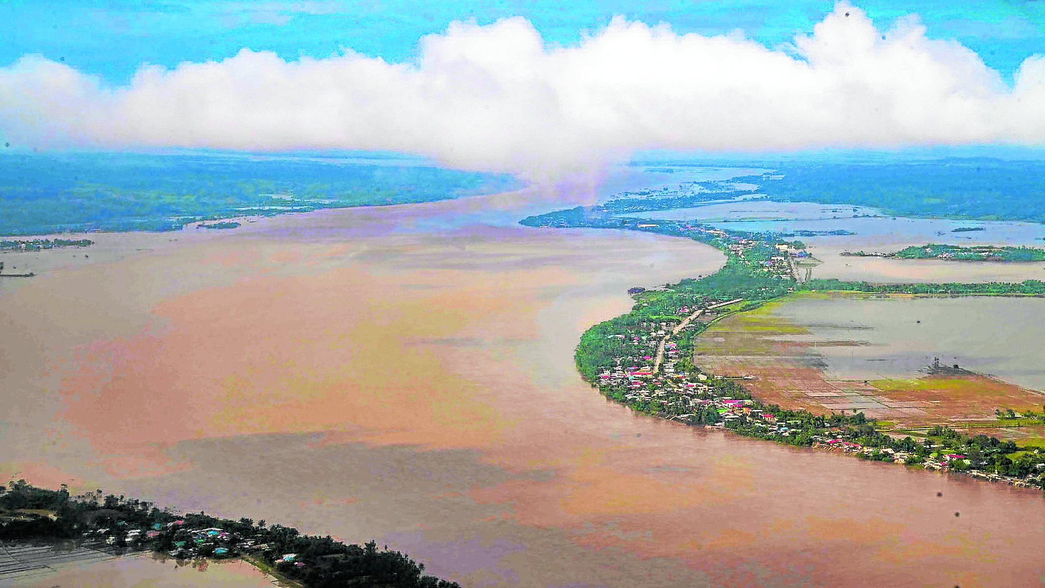
Flooding inundated large parts of Cagayan Valley
‘Project Raniag’
The hashtag topped Twitter’s trending list that evening and the next day. Over breakfast, my sister asked that we mount a relief drive which we called quite simply “Tulong.” Then, my high school friends would ask, aren’t we going to help? We launched a supposedly small Christmas initiative, “Project Raniag,” that very Saturday.
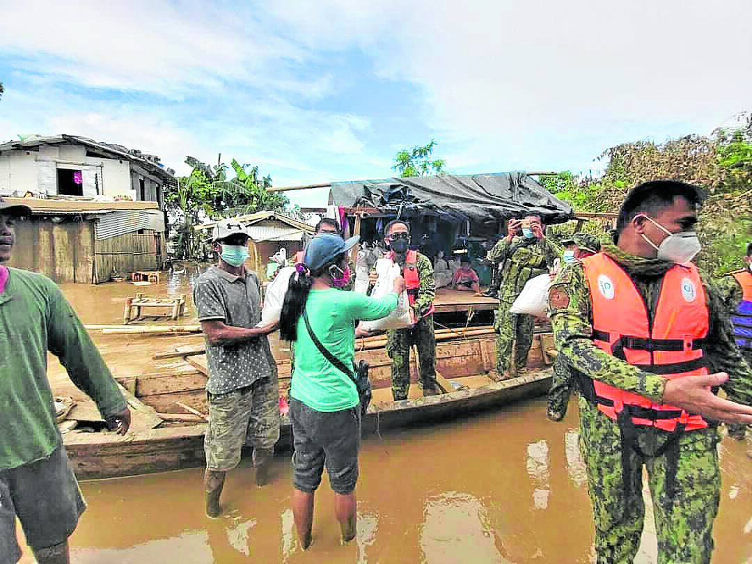
On Nov. 18, two days before our humanitarian effort visited the hard-hit areas, the NASA Earth Observatory released a satellite image of a swollen river spewing mud-brown water into the sea. It looked bad then, but it was worse. When we distributed goods, we followed the track of the mighty river and found heartbreaking scenes: plantations washed out or covered in debris, hands outstretched for help, homes covered in mud.
We have been used to disaster. What went wrong this time for my resilient valley home?
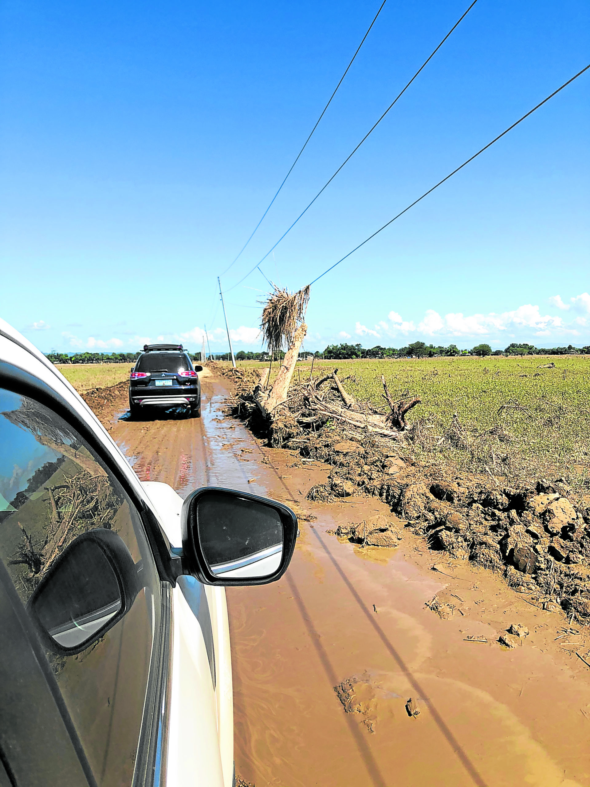
The roads had only recently been declared passable by authorities. Farms and power lines were washed out.
Largest river catchment
To understand the Cagayan River flooding, one must look at a confluence of factors. It will help to know the Cagayan River Basin, the largest river catchment in the Philippines, about 27,000 sq km covering Quirino, Nueva Vizcaya, Ifugao, Mountain Province, Kalinga, Apayao, Isabela and Cagayan. The rivers all empty into the Cagayan River, 500 km from Nueva Vizcaya to Cagayan.
The Magat River, which hosts the dam that some erroneously blamed for the flooding, is only one of the major tributaries. The list also includes Pinacanauan, Chico, Siffu, Mallig and Ilagan rivers. The average rainfall in the southern half of the basin is three times more than that in the northern part, so people downstream like myself are often puzzled why the river rises even sans rain in Cagayan.
Owing to Mother Nature, the river has a low discharge capacity even for a two-year flood event. Moreover, the Cagayan Valley has vast floodplains that retain water, the same places where farmlands and farmers’ homes are. Where the Cagayan River and its tributaries meander, floodwater can accumulate.
Right before the river meets the sea in Aparri, in the Magapit Narrows, it constricts from 400 to 180 meters. When we passed through the area for the mission, a large chunk of land had eroded near Magapit Bridge and a new landmass formed a few kilometers upstream.
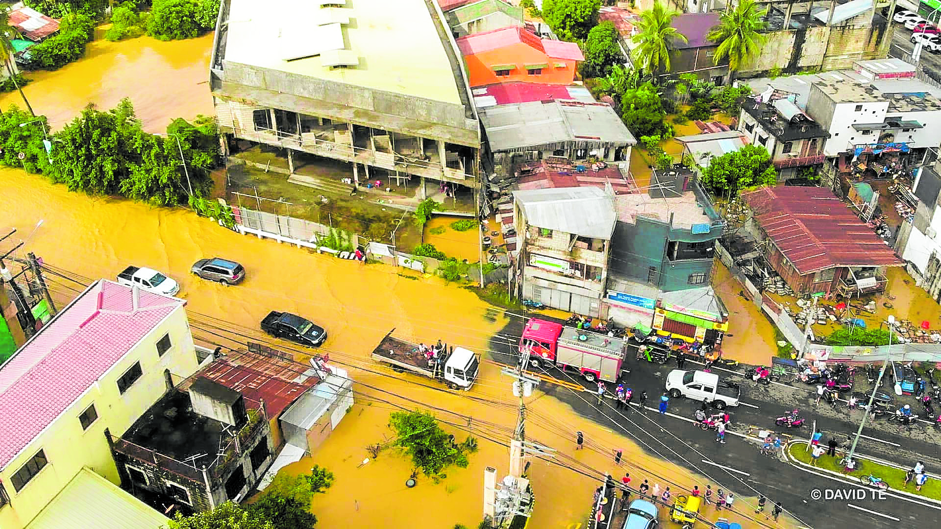
Cagayan is still reeling from flooding
Increasing capacity
There are many old concerns surrounding the river and its banks. We talk about and have seen efforts to dredge the river and install revetments to increase its capacity and prevent erosion, respectively.
A 2006 flood mitigation masterplan from the Regional Development Council noted 73 erosion-prone sites. Seeing how the river now threatens the highway system, we may need protection fast.
We can try building dikes and levees to protect low-lying areas. But, as New Orleans and its environs near the Mississippi River learned during Hurricane Katrina in 2005, the structures need to be sturdy and enduring. Bureaucratic corruption can lead to substandard structures and a lack of monitoring can lead to false security. After that US tragedy, levee wars began—higher-income neighborhoods built larger protective structures, worsening flooding in low-income communities. To avoid this on our riverbanks, we need coordinated efforts.
We can also create new buffers, backwaters and wetland habitats in the floodplains. That would take people out of harm’s way, help the environment thrive and add capacity for runoff.
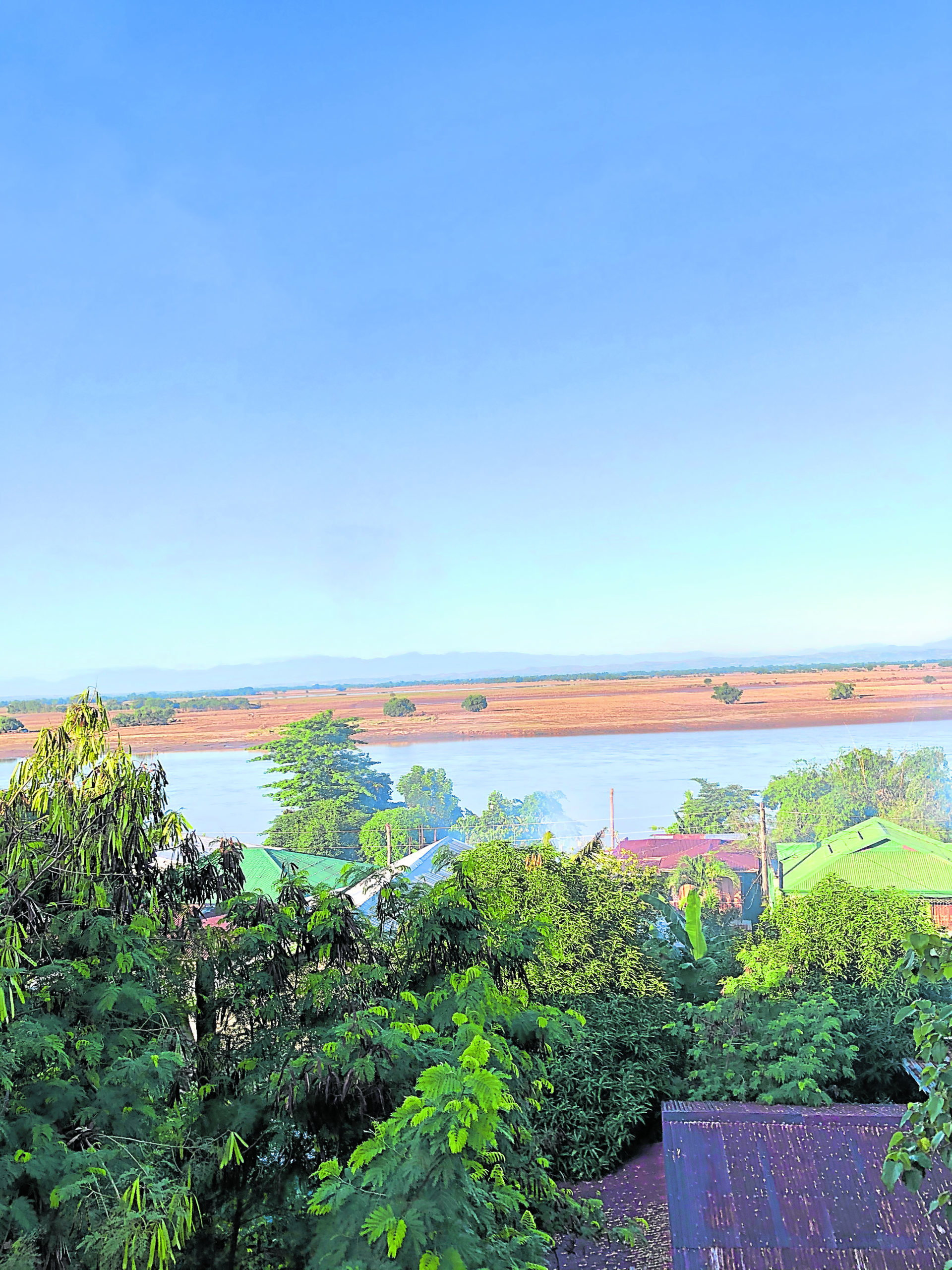
Cagayan River from Amulung viewing deck
Complex solutions
However, that would also involve the government helping majority-poor farmers find equitable and sustainable alternative livelihoods. Past government models found that flood-prone areas are planted to rice, corn, legumes and vegetables. A viable solution is agroforestry. It involves planting fruit-bearing trees and native timber, intercropped with cacao, ginger, etc.
As experts would note, a complex problem needs a complex solution. We must zoom out to the Cagayan River Basin. The Magat Dam only added to a complex web of issues. The expansive river basin had suffered a month’s worth of rain and tributaries had been swollen.
The longtime issue of forest denudation contributed to that. The 2006 report noted a decreased forest cover on the basin, most are already residual forest left by logging activities. Trees serve as water sponges and keep land intact. Less of them means more runoff, landslides and siltation. The Magat Dam reservoir itself has suffered increased siltation and sedimentation because of unabated slash-and-burn farming, quarrying and illegal logging, among others.
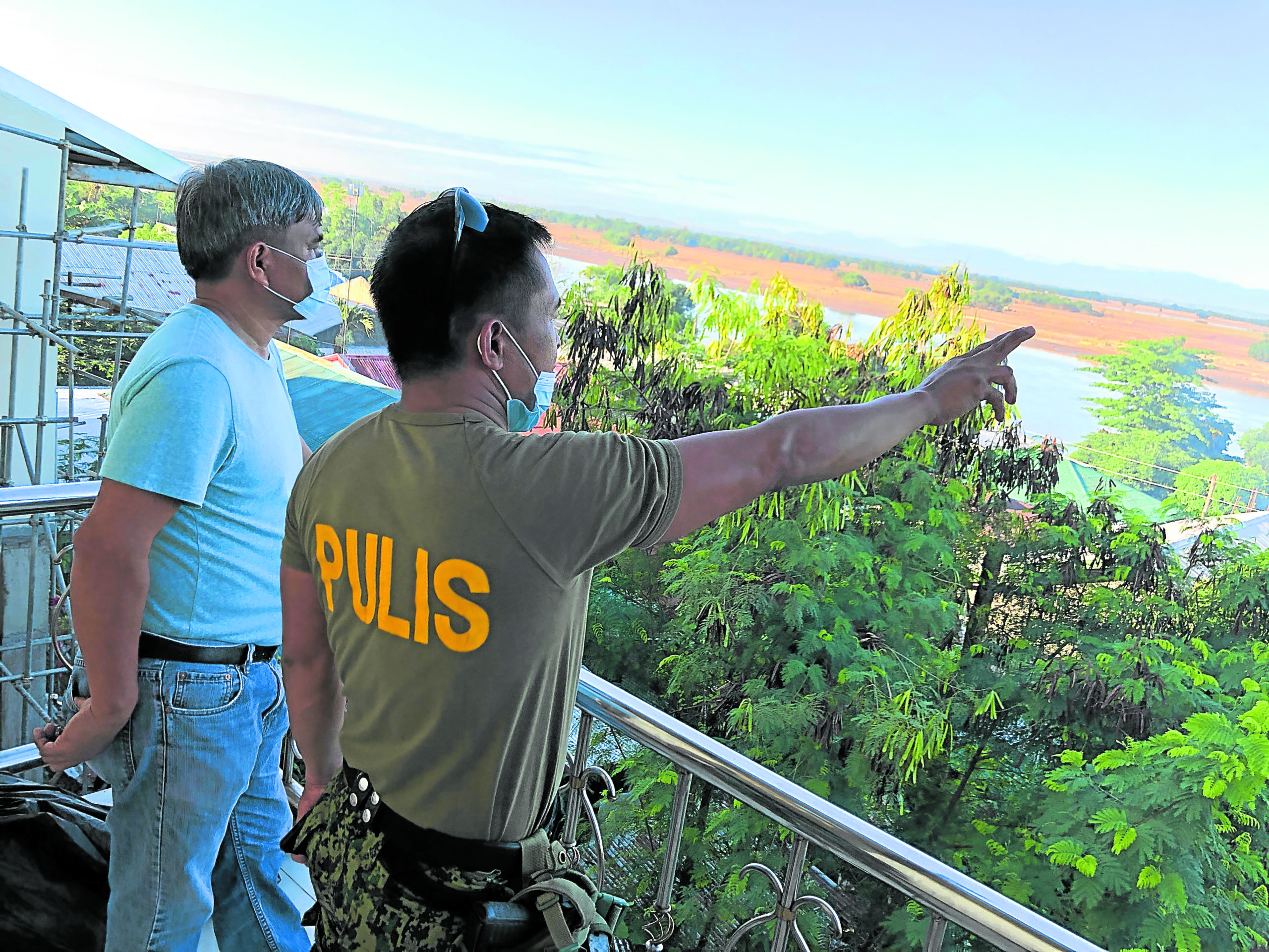
Amulung police chief recounts experience during flooding
Multilevel approaches
The major problem now is water overwhelming the Cagayan River. Multilevel approaches can address this. Highland areas must first ensure that forest covers are protected from harmful traditional practices and corporate greed, and denuded swaths are reforested.
Lowland communities and governments, too, must consider planting native trees in idle lands. Local governments may introduce small-scale runoff detention facilities to stall water. Japan created a large underground catchment that can take in, contain and discharge water on cue. Various cities creatively built cultural spaces and parking lots that, on rainy days, catch floodwater.
Citizens must also participate as their own roofs, concrete and lawns can decrease runoff absorption. Many residences and commercial buildings have now created green roofs, bioswales and other rainwater storage facilities. Some homeowners have planted rain gardens and begun “wilding” their yards. Perhaps governments can incentivize or subsidize flood-mitigation and greening projects.
In the past weeks, I had encountered scientific studies about the Cagayan River dating back to the 1990s. The 2006 study I cite impressively lays down short- to long-term solutions for 2006-2030, the goal is to help our province progress, undisrupted by these perennial weather events. It eerily contained a map showing flood-prone areas in a “100-year flood,” which happened twice in 11 months. While these may not ensure solutions that are appropriate on the ground, we at least have a basis for alarm, for action.
An appeal to leaders
Protecting the people from the Cagayan River will be a multibillion investment. A plan to widen it in Alcala town alone will cost P250 million. It is thus a test of political will from the local to the national level. In 2007, the Netherlands launched “Room for the River,” which was a submission to the fact that rivers swell. It led to several protective infrastructures and preventive relocations that took 11 years to complete.
As Cagayanos wait, we will have to endure the season, just as we have for centuries now—despite the effects of climate change, social inequality and more. From our own leaders, we appeal for better evacuation infrastructures and policies. We will also need clearer and timelier public advisories. Very much like the people of Eastern Samar were unaware of “storm surges” during Yolanda, a “flood may occur” warning does not stoke alarm.
We thank those who have sent help. As our waterproof spirits attempt to endure La Nina until May, may those who have shown us bayanihan keep reaching out. Cagayan still needs help.