In 1872, a Spanish expedition to the shoreline of Palawan came upon a hill with a steep downward slope. They surveyed the hill and found an extensive plateau ideal for settlement.
The Spanish settlement was founded on March 4 of that year. Called Puerto Princesa because of its superb location for excellent port facilities, it became a center of Spanish naval operations as its natural harbor met all the requirements of the Spanish Navy.
Puerto Princesa was declared the capital of Palawan by the American colonial government in 1911 and in 1970, nearly a century after it was established, it finally became a city. As the capital of Palawan, Puerto Princesa, which divides the northern and southern parts of the province, is the center of trade and commerce, communication, education and public administration.
Model city
In 2007, through a proclamation signed by then President Gloria Macapagal-Arroyo, Puerto Princesa was converted into a highly urbanized city, paving the way for the local city government to attain its development as a self-reliant community. Only a third of the population resides in the city proper, an urbanized settlement on the shores of Puerto Princesa Bay, while rural settlements are scattered in underdeveloped land.
In recent years, Puerto Princesa has earned the distinction of being one of the model cities in the country—in terms of cleanliness, environmental protection and conservation, and local governance.
In April this year, Republic Act No. 11259 was signed, dividing Palawan into three provinces—Palawan del Norte, Palawan Oriental and Palawan del Sur. The reorganization leaves Puerto Princesa, the only highly urbanized city in Palawan, as an independent city that shall have its own legislative district.
Infrastructure
Puerto Princesa is about 306 nautical miles from Manila or 55 minutes by commercial plane. The city’s airport and seaport are among the important transport links in the Mimaropa Region.
The new P4.5 billion Puerto Princesa International Airport terminal building, opened in May 2017, has a floor area of 13,000 sqm; a seating capacity of 1,500; parking slots for over 200 cars; a 2,600-meter runway; and six parking bays.
Agriculture and fishing are major industries in Puerto Princesa, which has a land area spanning 253,982 hectares and a coastline stretching more than 400 kilometers.
More than just a jump-off point
While it serves as a gateway to Palawan’s famed tourism destinations such as El Nido and Coron, its rich natural resources, biodiversity and scenic spots show that Puerto Princesa is more than just a jump-off point. Lush rainforests and white sand beaches are also just hours away from the city proper.
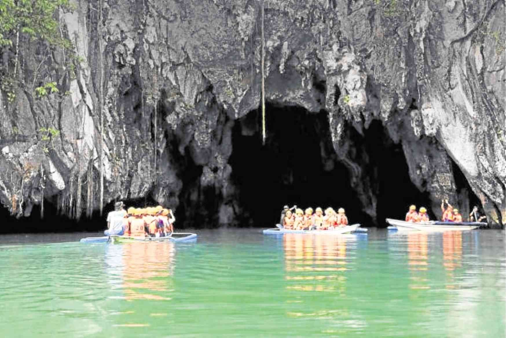
One of the places of interest around the city is the Unesco World Heritage site Puerto Princesa Subterranean River National Park or commonly known as the Underground River. Considered the longest navigable underground river in the world, it flows directly underneath St. Paul Mountain Range, passing through caves and rock formations.
Honda Bay is home to beautiful islands including Starfish Island, Snake Island and Pandan Island. Other sites in the city are the Palawan Wildlife Rescue and Conservation Center, popularly known as Crocodile Farm; Baker’s Hill; Mitra’s Ranch; Butterfly Garden; and Palawan Museum.
The city government has also taken notice and tapped the local cherry trees, known as “balayong” (Cassia nodosa) to boost Puerto Princesa’s image branding for tourism just like Japan’s cherry blossoms. During summer, balayong trees—which are found on main highways, public parks and campuses—are in full bloom, capturing the attention of tourists and locals alike.
Besides tourism, agriculture and fisheries, the city looks forward to investments in renewable energy generation and information and communications technology facilities.
Sources: Inquirer Archives, puertoprincesa.ph, psa.gov.ph