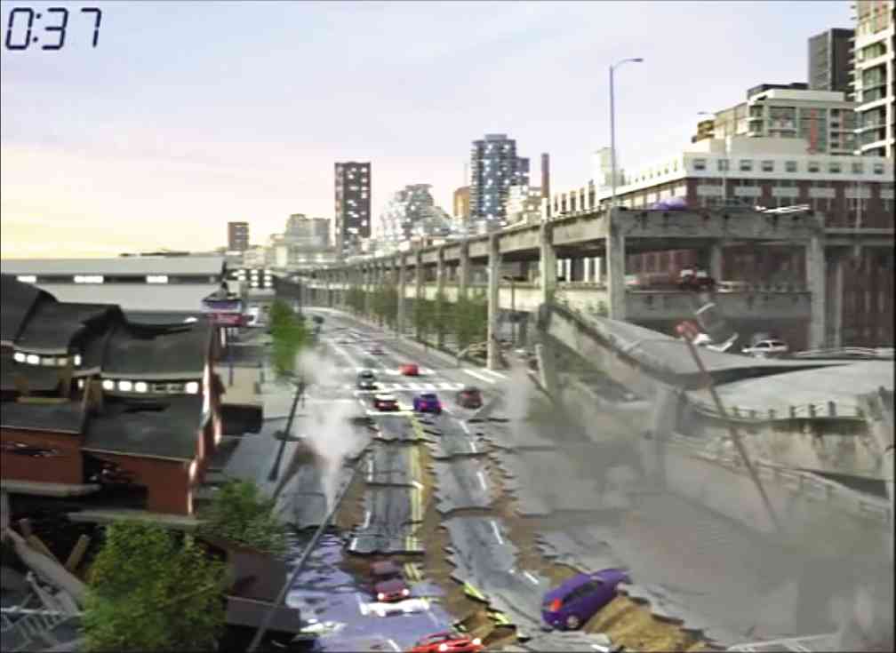
Spooked by the destruction left behind by the devastating earthquake in Nepal, the Philippines is now on high alert in terms of preparing for the “big one.”
According to the Philippine Institute of Volcanology and Seismology (Phivolcs), the 90-kilometer West Valley Fault—which runs from Bulacan through Metro Manila to Cavite and Laguna—may move anytime, triggering a potentially massive quake.
Because of this, various government agencies including Phivolcs and the National Disaster Risk Reduction and Management Council (NDRRMC) have started rolling out preparatory and response initiatives for when a high-intensity earthquake hits the region, especially in July which is National Disaster Consciousness Month.
This, however, may use an additional layer of preparation by looking at the structural integrity of buildings and infrastructure in the country.
According to Gianluca Lange, regional industry manager of 3D design solutions provider Autodesk, evaluating and fortifying the capability of houses, buildings, and other infrastructure to withstand earthquakes, or at least minimize their effects, is one vital key to earthquake preparedness.
“Buildings and infrastructure fail because they were not originally designed to withstand the impact of natural disasters such as typhoons, earthquakes, volcanic eruptions, flash floods and tsunamis,” shares Lange.
Lange believes that using the right design and materials in the construction of buildings will allow structures to withstand not just earthquakes, but natural disasters in general.
Lange emphasizes that while authorities are actively implementing protocols to help prepare the Philippines against earthquakes, the protocols play mostly on what should be done in the event of an earthquake.
“The Philippine government is carrying out several initiatives to help prepare key areas like Metro Manila in case an earthquake happens and we applaud the government’s effort and programs,” says Lange.
“These are all a good start, but admittedly, can use a little more push,” Lange adds.
He says that in addition to these protocols, government agencies and city planners must make use of the available tools and measures to prevent and reduce earthquake damage.
“Given that much damage not just in properties, economy, but also life will be involved, spending for tools and initiatives that will help prepare the community for natural disasters isn’t supposed to be considered as an investment or cost, but as a form of ensuring public safety and security,” he says.
“Because while we cannot stop a natural disaster, we can do something about minimizing its effects on people’s lives as well as on the economy of the affected area,” he concludes.
By looking at the structural integrity of buildings and infrastructure, damage caused by natural disasters can be minimized.
According to the 2004 Metropolitan Manila Earthquake Impact Reduction Study (MMEIRS), if a magnitude-7 earthquake were to hit Metro Manila, it will damage 40 percent of residential buildings.
It will leave more than 30,000 people dead and around 110,000 wounded, around 10 million square meters of total collapsed areas, and almost P2.5 trillion worth of destruction.
With this, Lange cited recent advances in design technology that are presenting stakeholders such as city planners and builders with opportunities to create disaster-proof infrastructure and strengthen the structural integrity of existing buildings.
“Technology can provide governments, planners and engineers with essential feedback, offering a better way to predict behavior of the built environment or soon-to-be-built environment during a crisis,” he explains.
“In effect, advanced technology provides a proactive method to more effectively create disaster-resistant communities,” he adds.
Among the technologies that can be used to aid stakeholders in urban planning and disaster-proofing, he says, are 3D design, structural analysis, fluid dynamics and simulation.
Simulation, for example, allows engineers to use response spectrum analysis to determine the structural response to sudden forces or shocks such as an earthquake.
During an earthquake, violent shaking is transmitted into a structure at the points where it is attached to the ground.
To help engineers design sound structures, response spectrum analysis is used with information gathered by instruments from past earthquakes.
He says that an engineer can determine how a structure would react to a past real-world earthquake and consider it in new designs.
3D design can also provide insights about existing conditions, which are integral in developing and implementing earthquake-proofing designs and techniques.
Because 3D models are accurate representations of real-life structures, they can for example help local and central governments, consultants and even the public understand how and where to prioritize restoration efforts in the wake of a disaster so repairs can be made immediately.
“This is particularly relevant for damaged utilities networks, whose “up and running” status is essential for life and business to return to normal. As well, the model can be used to more effectively plan the city’s future build out,” says Lange.
“In essence, design technology has always been an enabler and a tool that allows us to expand our human capabilities and reach new grounds in any endeavor that we wish to pursue,” he adds.
“Perhaps it is a matter of understanding the amount of capability that various stakeholders, both public and private, can do with the wide array of design tools available today. Nevertheless, the tools are all there,” Lange says. “All we need at this moment is a sustained participation from all stakeholders, social awareness, and a massive amount of dedication to public safety to ensure that these preparedness initiatives are done quickly,” he adds.


